
Terangganu, Malaysia just might be the most relaxing place you have yet to hear of (or maybe you do know about it, and I understand why you want to keep it a secret).
Whether its the ever-breezy Terangganu air, or the thought of having a chef deep-fry a brimming selection of sea food for you – Warung Pak Nong Restaurant is a restaurant with something for everyone.
…and its where we are going for lunch today!
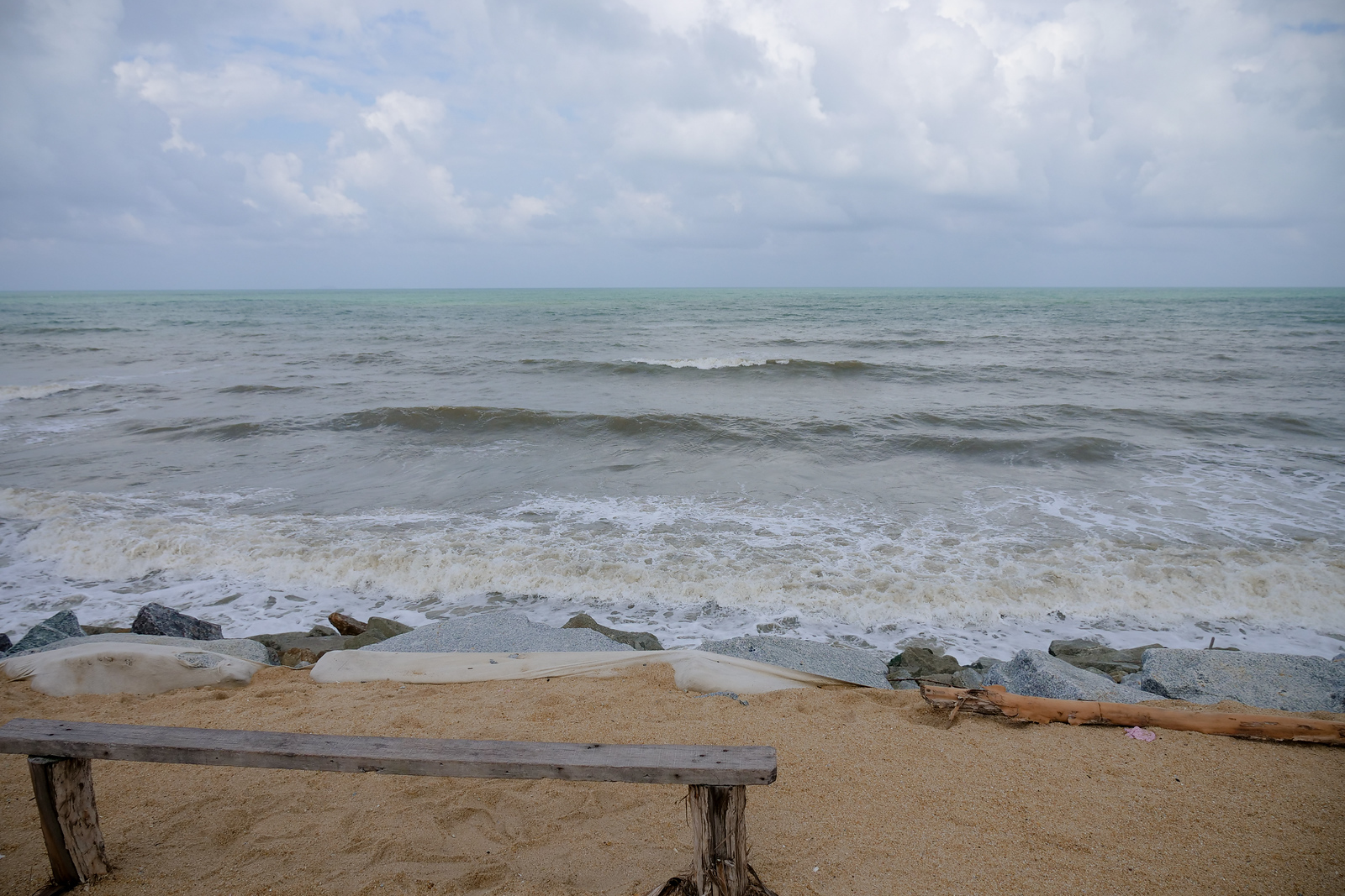
Its a ‘Win-Win’ with Beach and Beach Food
Its pretty much a win-win scenario anytime you find yourself enjoying a gorgeous beach view, while waiting for a feast of seafood to arrive at your table.
Listening to the ocean spray while feeling the warm breeze, sitting in shade while watching the waves is perfect – until a team of friends next to you starts calling out for help.
No worries today though, because the only problem here is, your friends are calling you to help them eat!**
With An Indoor Take-out Line
One of the things that makes this Terangganu restaurant so fun, is how they organize the restaurant to maximize both convenience and speed, while also maintaining a comfortable make-yourself-at-home type vibe.
I can only think to call it a dining-in take-out line, and the way you order here is just great.
Scroll down now and learn ‘How To Order.’
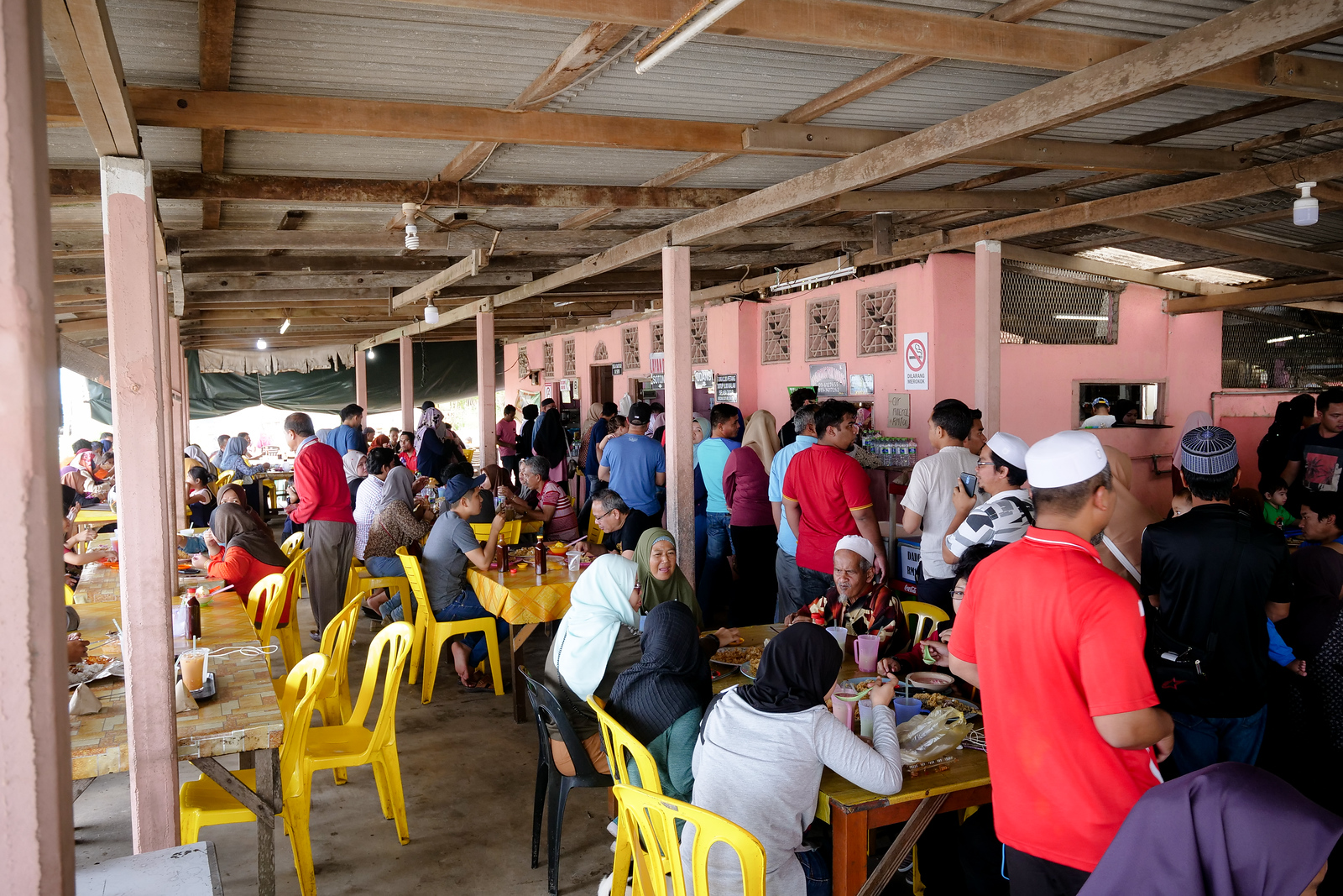
Incredibly Busy, And Fun
There are a few tables out in the open air (on either side of the restaurant, parallel to the beach front), but most of the tables are under the main roof building.
You will need to order both your drinks and your food yourself, but they will help you carry the food (which is good, because you’re going to want a lot of it).
There’s a line for drinks, and a separate line for food, and if you’re following the main flow of things (just look for the unmistakable line of smiling and hungry customers), then food is what comes first.
NOTE – A Couple of Warnings
Remember to always ASK before tagging your friends on Instagram, or they might get in trouble for cutting off work early on a Wednesday (we were fortunate to be in this situation not once, but several times – and I can only say a big ‘Thank you!’ Malaysians love to eat, and we were only too lucky to be there with these new friends today).
Note:** Big reminder here, this place is really popular, I am not kidding – although it was only after finishing off the first five or so plates of seafood that it came to our attention – this restaurant usually needs reservations from the day before you want to visit!
Terangganu Seafood Strategy at Warung Pok Nong
Step 1: Seafood
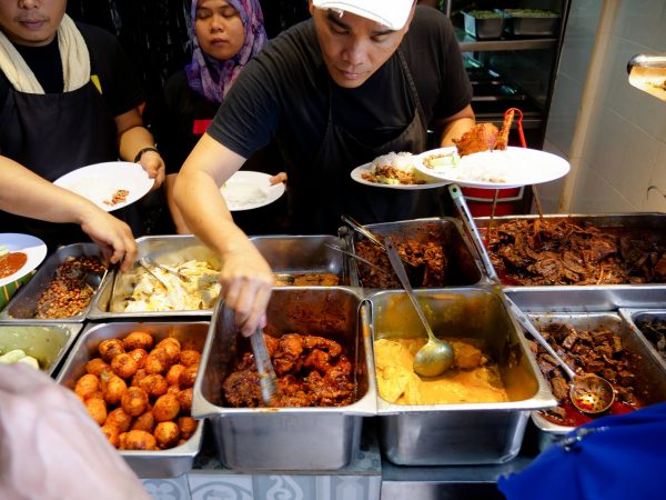
‘Warung Pok Nong’ Restaurant specializes in deep frying seafood, and there are quite a large number of choices and styles for you to choose from.
Due to the straightforward ordering (every customer lining up in front of the counter like school students) they keep the order line wonderfully simple.
Everything is deep frying, moving straight from the fryer, to the dripper, to your plate, to your table, each plate comes with a small saucer of red sauce. Wait for your turn in line, give your order of type of seafood, and how many plates, and finally point out to them the area in which you are sitting.
Get exclusive updates
Enter your email and I’ll send you the best travel food content.
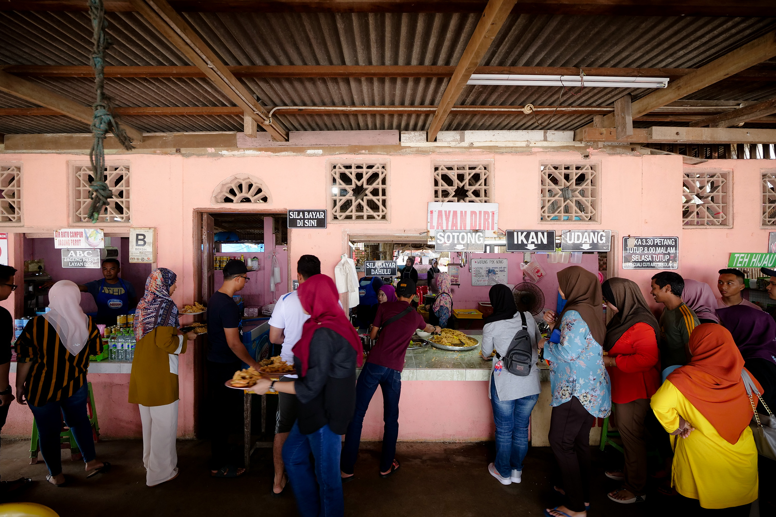
Move to the drink line.
Step 2: Drinks
The next thing to do will be a drink order, but they have separate places for ordering either mixing drinks or water. The water (and coconut water) is to the right of the food ordering, while the drinks that take preparation (coffee, tea, three-in-one sweet powders) are on your left.
Its not as complex as it may sound, because you can actually try to order drinks from your table (timing it right, just when a server arrives with the food). Its just that this restaurant can be so incredibly busy, its sometimes just quicker to just make the move yourself.
Step 3: Seating
The amount of seafood they fry here is incredible, and it won’t be long before your order will arrive.
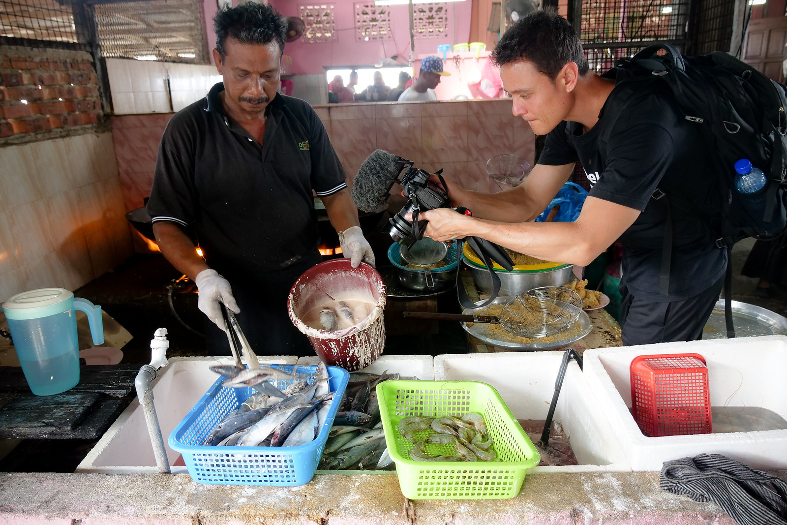
If you want to take a moment to witness the chef in action, gently walk through the central door, and make your way around the back.
The chefs here are so friendly, it was great to see them laugh as we stared in awe, the sheer amount of oil, of seafood, and the massive size of all the frying pans – it is quite a sight to see.
And of course, one that will make you uncontrollably hungry in no time.
Go back outside and try to find a table, and of course for seating, and then for eating, this step is always more easy to do with friends.
Crispy and Crackling Assembly Line
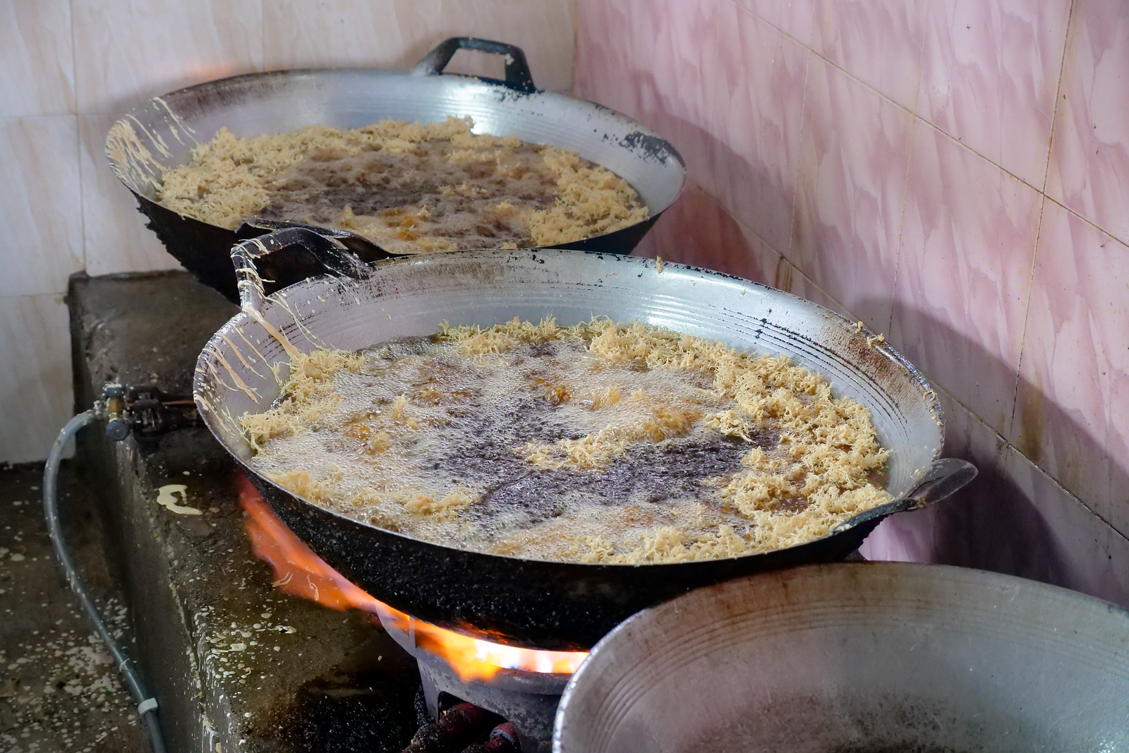
The sounds of nearly 10 giant deep-frying pans full of fish are easily heard all the way from the ordering line.
Walking back into the kitchen is surprisingly relaxing however, and its clear to me from this lunchtime at least, that people of Terangganu are very comfortable working with gigantic amounts of frying seafoods every day.
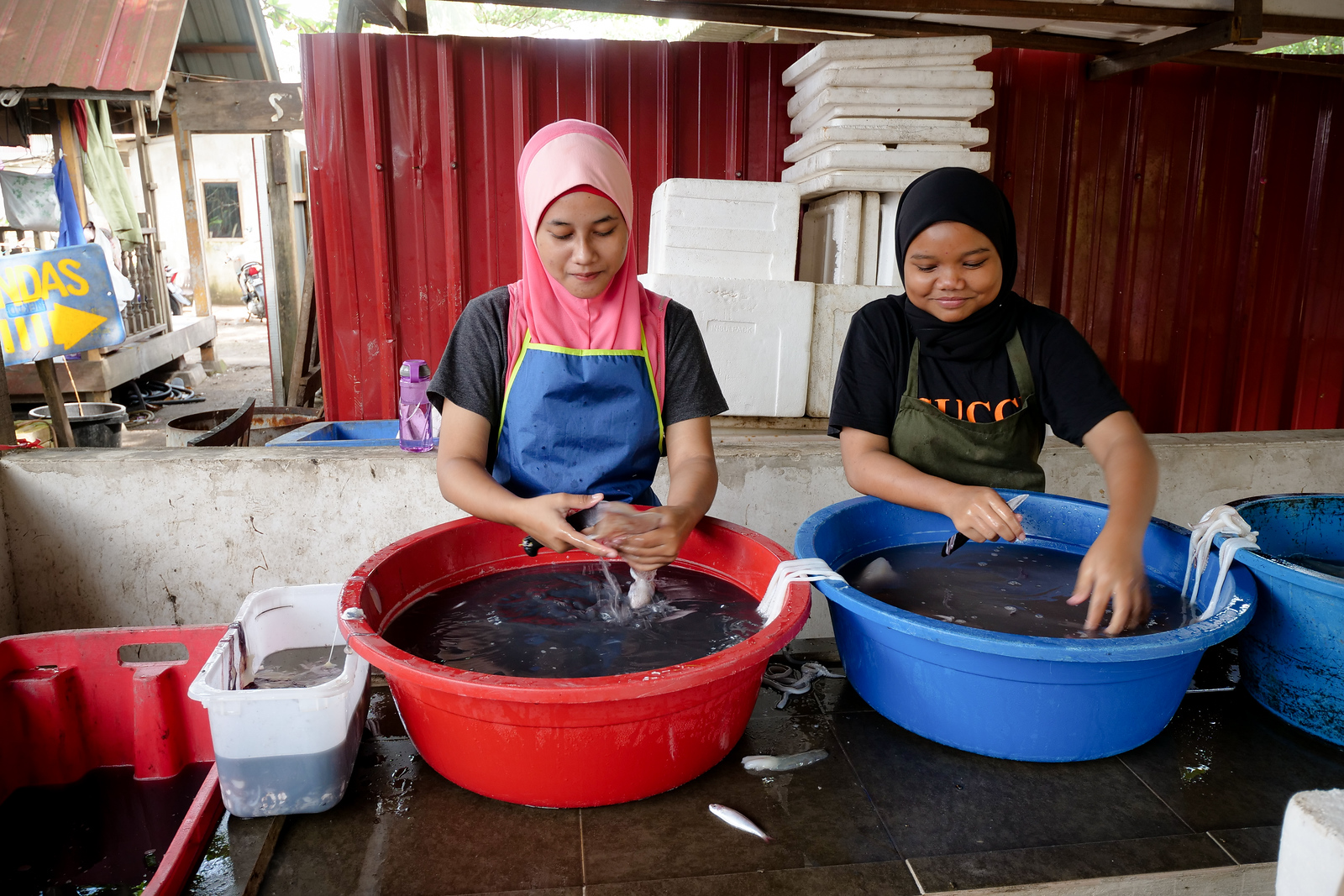
These two young ladies were enjoying a chance to show us how to properly clean each squid for frying.
One girl gently removes the inside parts of a squid (including the ink sack, which is usually kept), and then gives it a quick rinse before passing it down.
The second girl then quickly yet smoothly removes the squid’s outer layer of skin with a knife, making small incisions before removing it all by hand as one shiny purple sheath.
Smaller squid will still have tender skin, but with fat and more mature squid like these, the outer skin can be tough after frying.
The Lunch Feast Begins with Fish
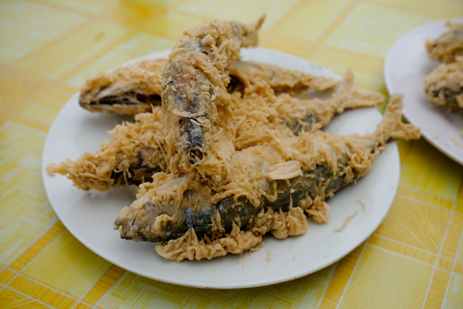
The first of the fried fish are ready, the first of several other plates that were on their way.
To quickly describe a bit about the mackerel, you will see why its just a perfect fish to deep fry.
The mackerel does have scales, and therefore it is halal and safe for Muslims to eat, but the scales are so small that the skin is almost velvety to the touch – which presents no problem at all to our teeth after these fish deep fry!
I am amazed at how light and golden the color is of these fried, crispy, little fish, and there’s nothing like a display of fish like this to get the appetite going.
Above all else, this is just an incredibly fun finger-food, and so just after the moment they are cool enough to touch, dig in for your first finger-ful of white, mackerel meat.
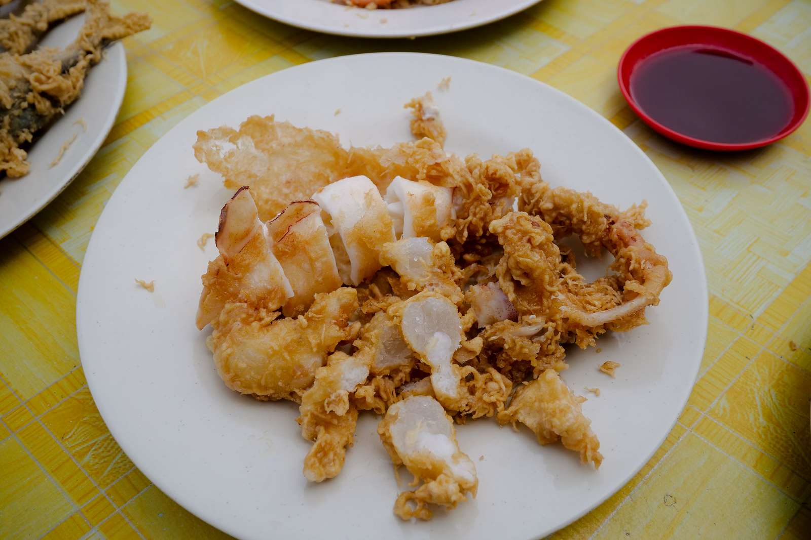
Fried Squid
The squid here are a miniature epic of a journey of texture – I absolutely love each bite of these.
Frying to quite a hard, crispy outside, yet so thin, giving way immediately to the bouncy, nicely chewy, thick white meat within. Take the scissors provided, and cut each piece yourself before eating.
Squid to me is more about the texture, but there is a richness and fattiness there as well. Our squid actually came full of eggs, and these roe look beautiful as well, like a little bowl of glass beads inside each squid.
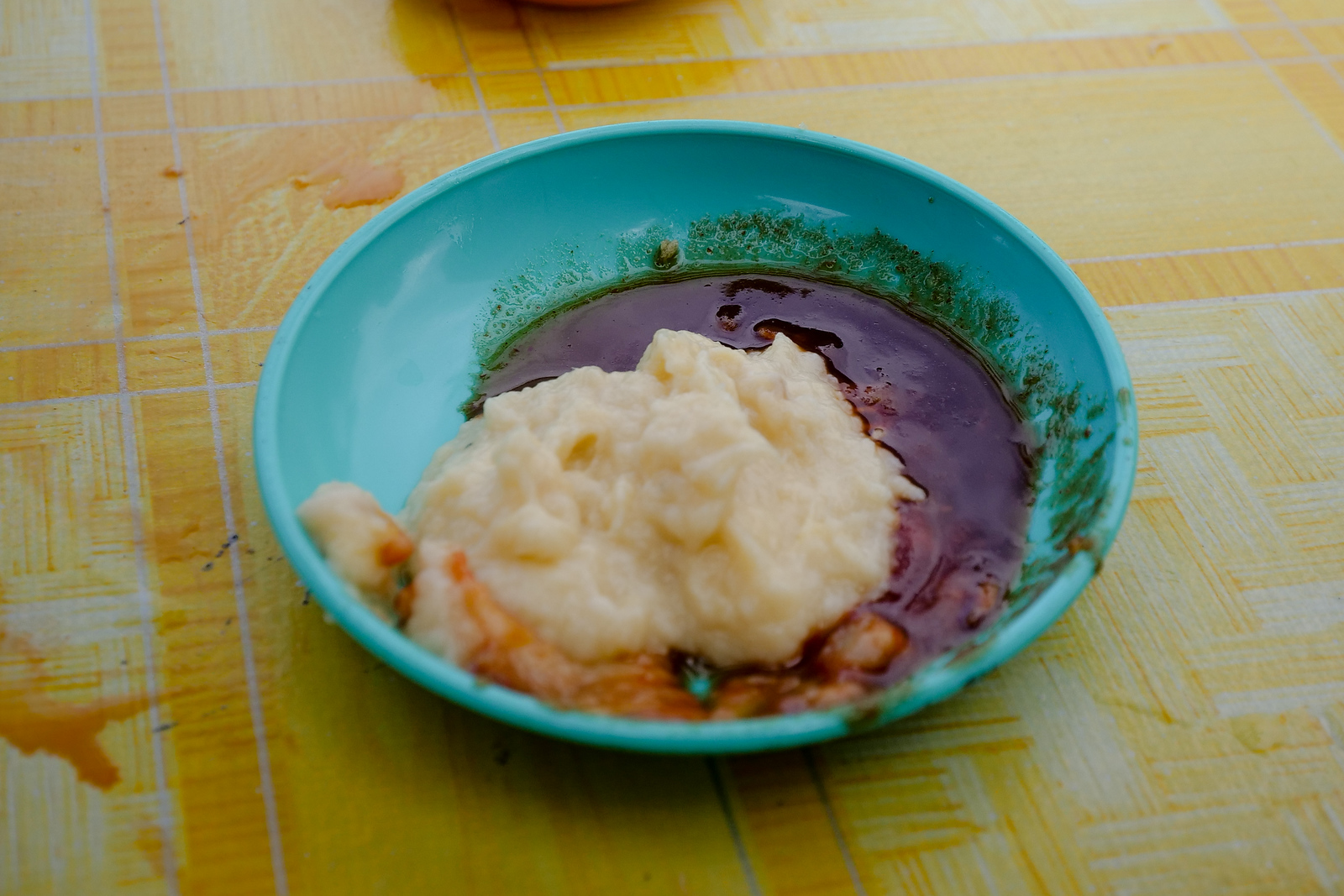
Sauce to Your Heart’s Delight
The deep frying may leave them with a bit less flavor on their own – so you may eventually want to grab a sauce to go along with these bites as well.
The restaurant has a dark sauce that comes with the squid, it smells sour and tastes slightly sweet, and while I wish it was a bit more spicy, it really goes great with these squid.
These plates of squid were gone in a hurry, I was very thankful to see still many more plates of both fish, squid, and then shrimp, on their way from the hot oil drip trays to our table.
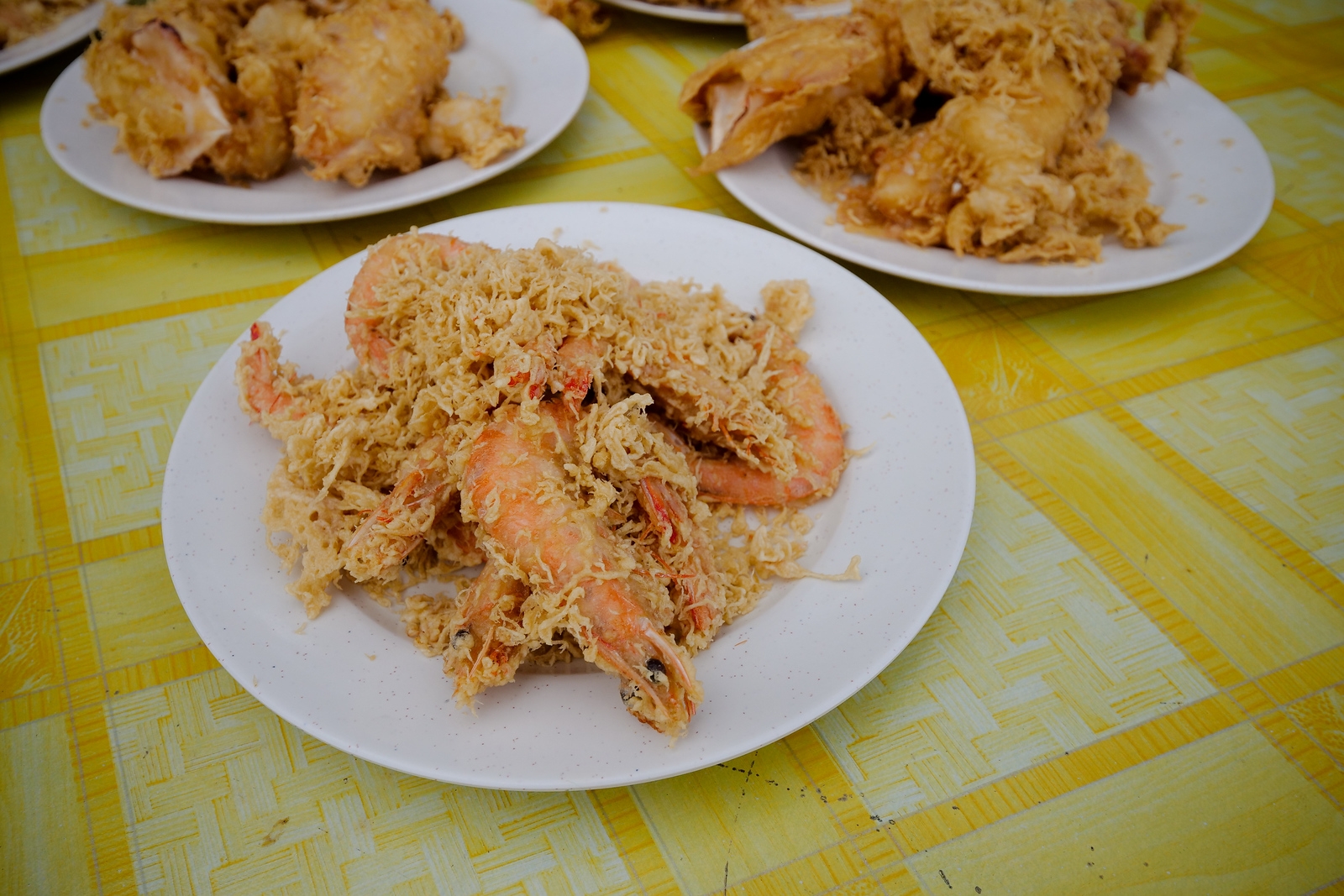
Fried Shrimp
At last, the plates of huge shrimp arrive, the one dish I never can wait to try (I won’t lie, I may have burned a finger or two, reaching in before they even hit the table).
The shrimp here are huge, they can only fit six or seven to a whole dinner plate, and the small bits of crispy batter on top add a nice finishing touch for presentation.
The large scales on the back are only too easy to peel off, and the sweetness of each bite of shrimp meat is sublime. Crunch to your heart’s content, and cheers your friends to another successful day complete (yes, even though its only lunchtime!).
It is a must-order here at Warung Pok Nong restaurant, it is mandatory to finish off approximately one plate of these shrimp per person before anyone can dare mention thoughts of a departure.
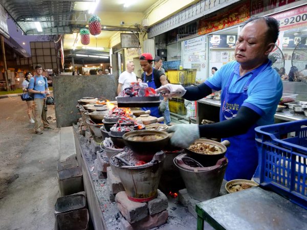
Behind the Scenes
The final step before each batch of seafood is ready includes a behind-the-scenes action that I also want to share with you.
The chef cleans out each pan of a truly unbelievably amount of crispy batter that falls off during the cooking. He swoops these all out, swishing through the oil with a huge screen tool, and moves most of the fried-to-a-crisp bits of batter into a collection urn directly behind him.
Note: A few bits to go on top of each plate, but the majority is not used for food, but goes to feed the families chickens that live out behind the restaurant instead.
It made the experience all the better still to see how, even at such a busy and popular looking restaurant, there was still a very normal and local family life in action. Their lives here are growing and happening along with the restaurant’s growth as well, and it is nice to see a direct view of one local family serving food (and their happiness) to so many other families coming for a meal.
The Restaurant Experience
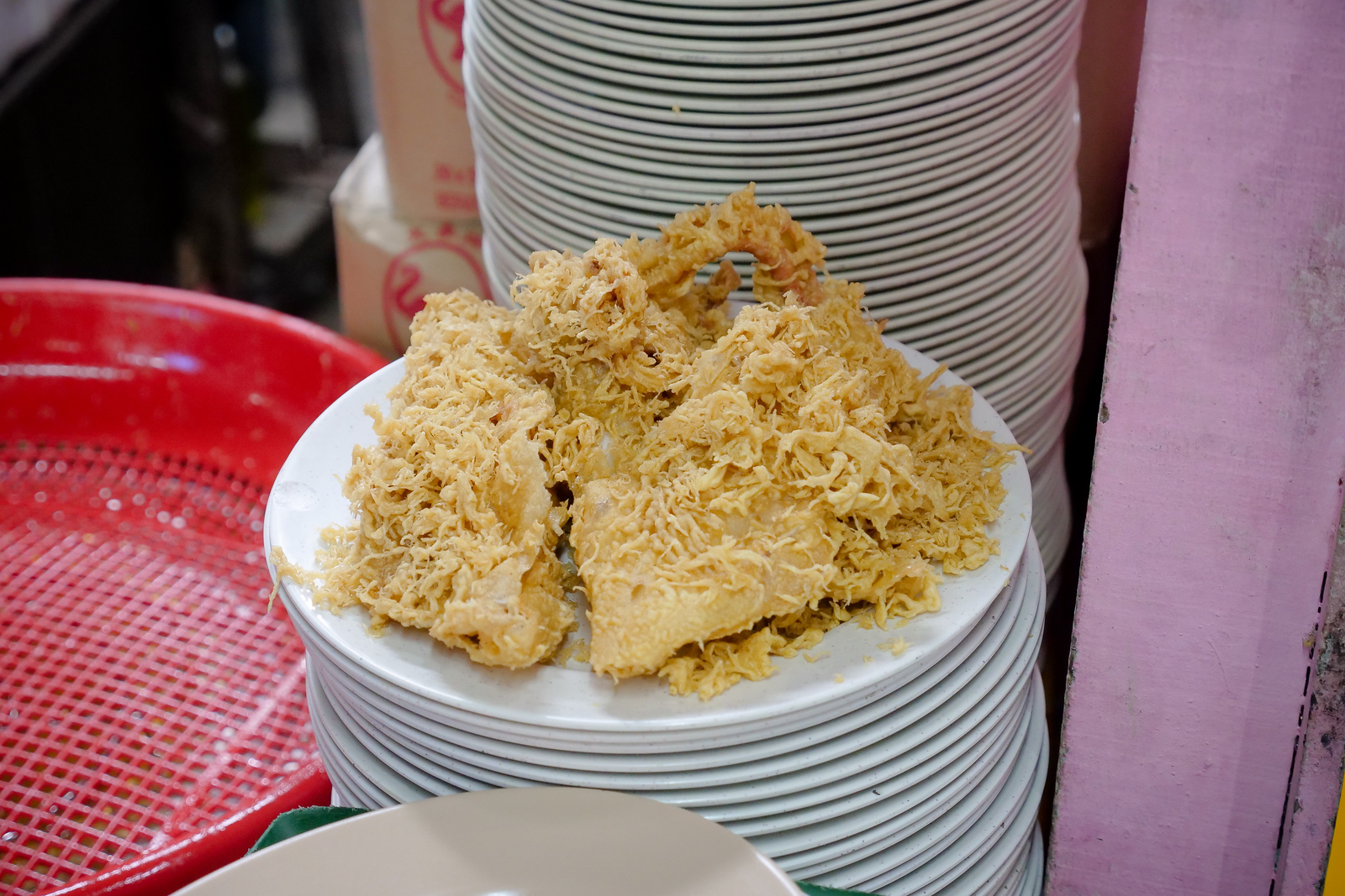
It is a good day, anytime you can both visit the beach, and hold down ratios of over a dozen items of seafood per person per table. Incredibly, our huge order this day still did not include the full variety of seafoods (or desserts) available at Warung Pok Nong.
There are also huge crabs (frying shells and all), a few other types of fish besides the squid, mackerel, and tuna in our order today, and then deep frying fish balls and tofu which also seem to be favorites here as well.
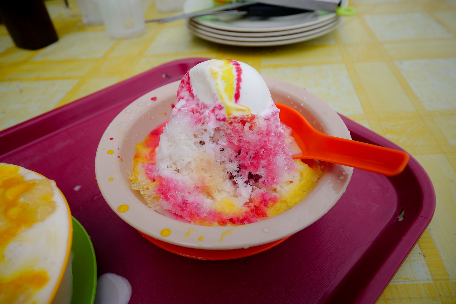
Finally, you can notice on nearly every table in the restaurant, a dessert order of this bright, cooling, ice cream and shave ice combination.
I did not try this myself, but a few people at our table say that it is very sweet, refreshing, and a perfect finish to the more heavy seafood options in a meal here.
Terangganu – The Perfect Beach Atmosphere
The seafood options here are wonderful, but I would say that its the atmosphere and location of this Terangganu restaurant that would keep me coming back.
I couldn’t imagine a better place to go for a mid-day meal with family and friends, an exciting (the amazing food) yet laid-back location (the beachside seating), a wonderful example of Terangganu food and culture.
It definitely reminds me of the last time we had a seafood feast in the sand, that time on the Arabian Sea near Karachi.
If you are visiting Kuala Terangganu, be sure to check out a few of our other articles as well – here is a jaw-dropping meal of local Terangganu-style breakfast at Nasi Dagang Atas Tol, and I would recommend following this by a lunchtime feast at local favorite Aroma Kampong Restaurant for fish, soups, and of course, tempoyak.
Note*: Tempoyak is not for sale here, but if you do happen to be carrying some (like we were, from the first time we saw it available at the market, until the very last meal of the entire trip), then feel free to add a few dollops to your own small dipping container.
Name: Warung Pok Nong
Location: Google Maps (link)
Hours: 3:30pm to 8pm (Closed Tuesday)
Price: Our meal for 8 people they gave us entirely complimentary.
Fish Head Curry + Amazing Malaysian Food at ‘Tugu View Cafe’
Best Restaurants in Kuala Lumpur, Malaysia (Must Try Local Foods)
Get exclusive updates
Enter your email and I'll send you the best travel food content.