
Favelas are the informal communities of Brazil, sometimes called ‘urban shantytowns.’
They are home to amazing and real people, and a culture you aren’t likely to see anywhere else in the world.
Scroll down now, and I will share with you some stories (several of them delicious ones!), to try and give you a brief glimpse into life in Brazil’s largest favela.
Welcome to Rocinha.
Should I visit a Favela?
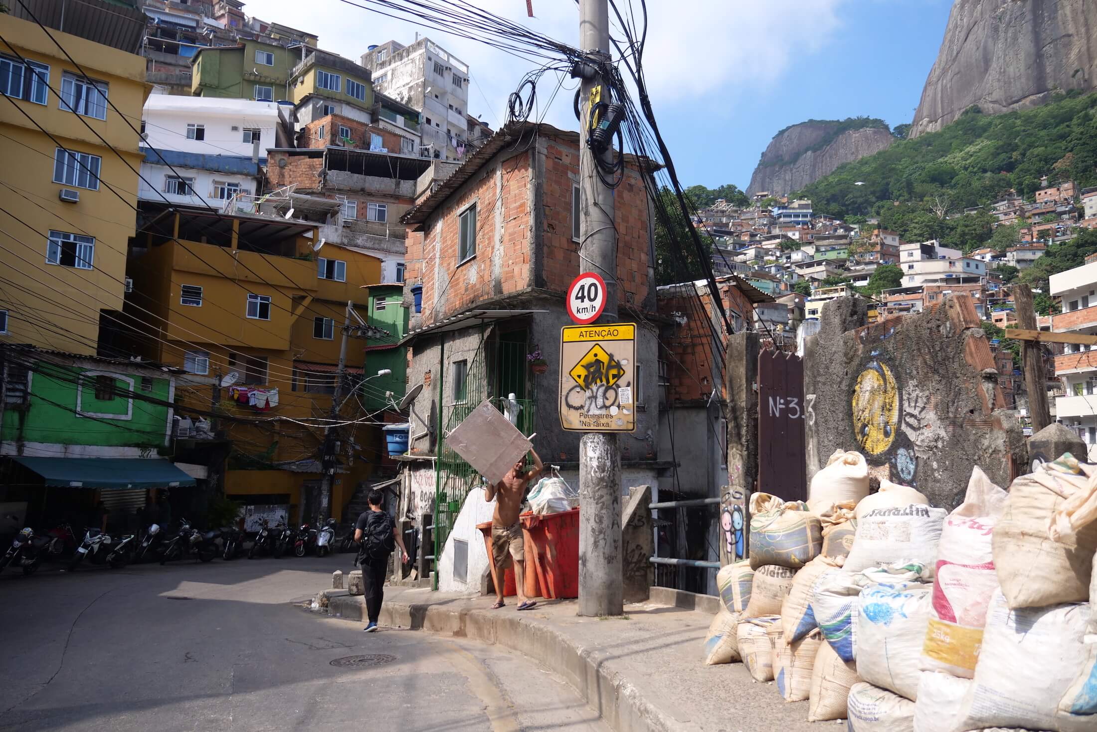
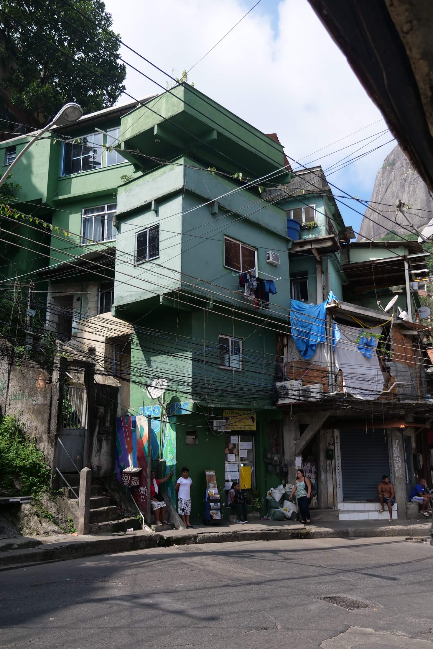
Favela life is usually one of high population density, and in larger Brazilian cities you’ll see them quickly extending up many of the steepest hillsides in sight.
Not slums mind you, but just areas where life is less ‘regular,’ where things might not always work out the way they do in areas of a bit more planning.
Rocinha favela for example, has running water, and electricity in most homes, as well as schools, banks, convenience stores, and pharmacies. Again, these are definitely not ‘slums’ of Brazil.
Just a Caution
In Rio de Janeiro specifically though, favelas do not have the best reputation for safety – and specifically Rocinha is often in people’s minds – partly due to the local news – as quite a dangerous place to visit.
Please exercise caution wherever you go, of course, but remember that at no time can the television ever give you the entire story.
Traveling in Brazil, be aware as you would in any completely new surrounding, but while you are here, I assure you that there is no need for anyone to simply fear a favela outright.
Wonderful Memories
Favelas truly are some amazing places of this world.
Honestly, there are few times traveling in Brazil where the heart and soul of a place is more readily obvious.
In my opinion, a day spent visiting a favela will likely give you some of your favorite memories of your entire trip to Brazil.
Rocinha is a Huge Neighborhood
The vast majority of people here work towards and look for the same things in life as you or I.
I can tell you honestly that everyone we met was both friendly, and very happy to share life with us, and for that we say a big thank you to all the inhabitants of the Rocinha neighborhood.
We were so fortunate to be able to visit several other favelas during our time in Brazil as well, but for now, I would like to share with you just a few things to do in this Rocinha favela.
If you haven’t already, watch the YouTube video from this day here (YouTube link).
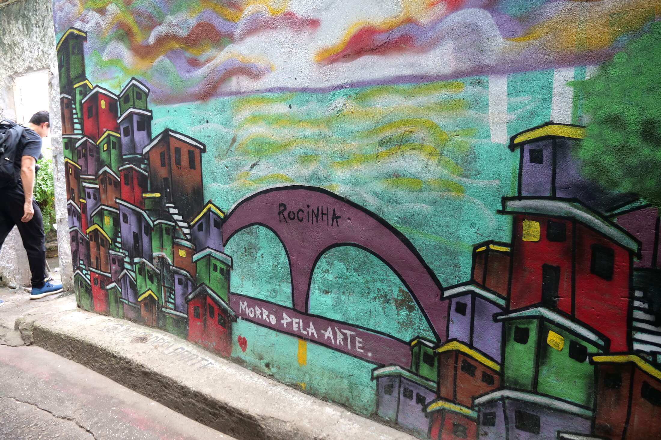
Rocinha Favela – Vibrant Humanity
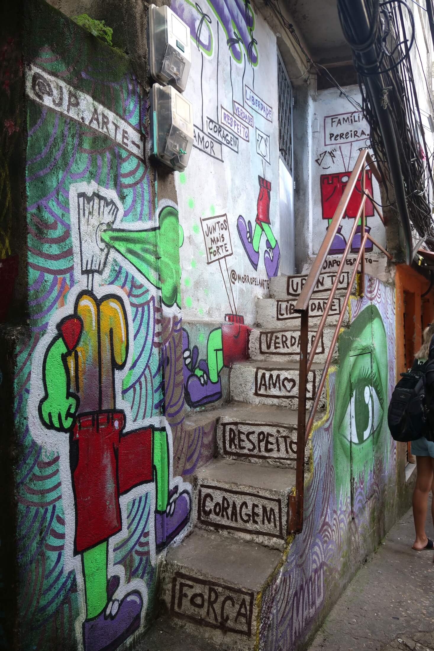
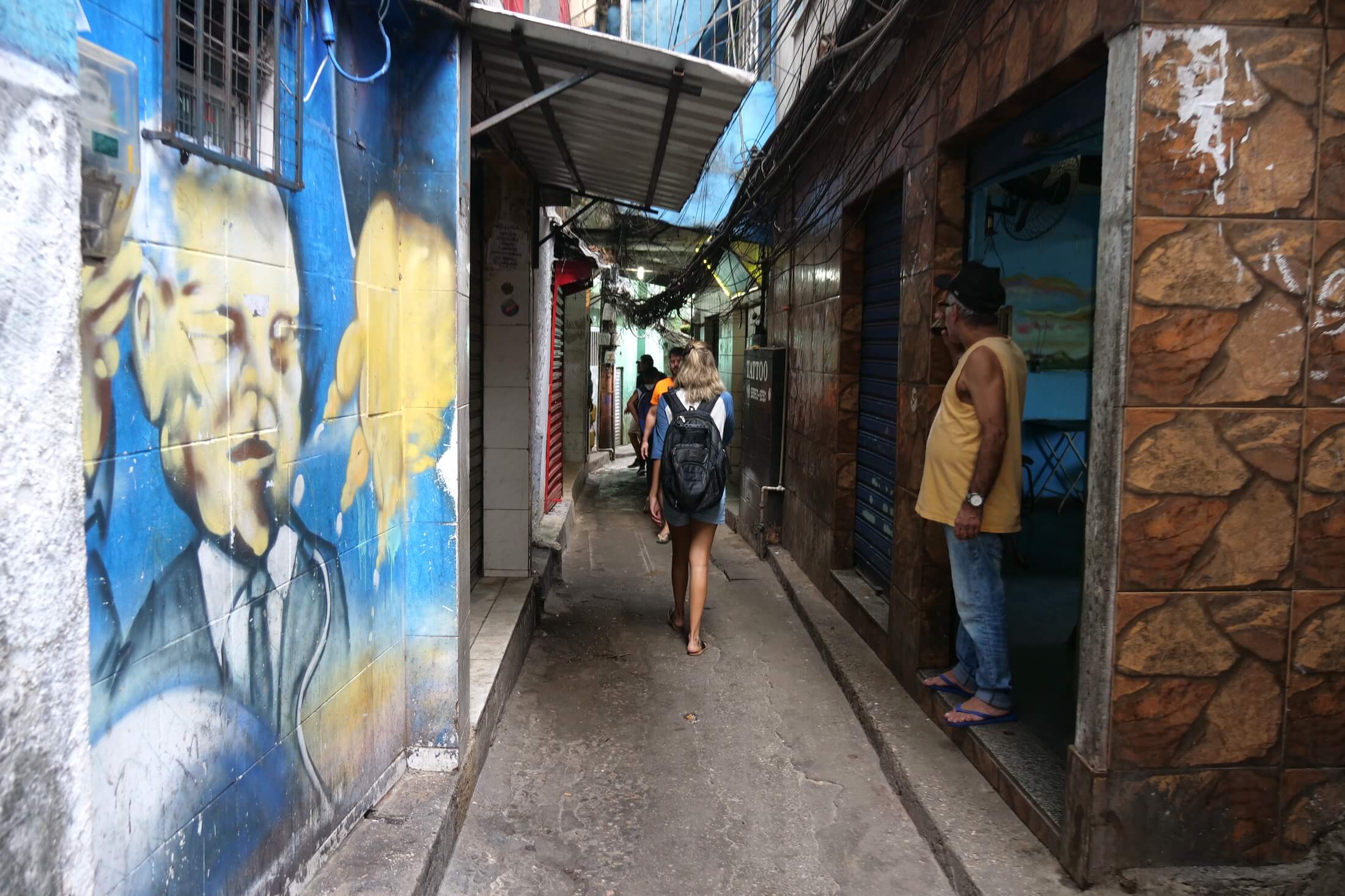
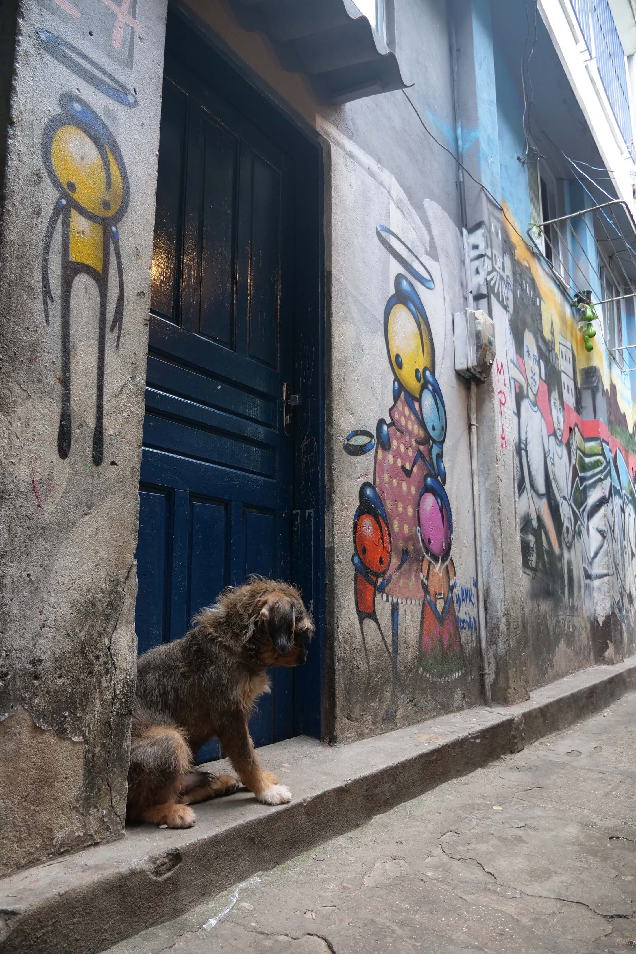
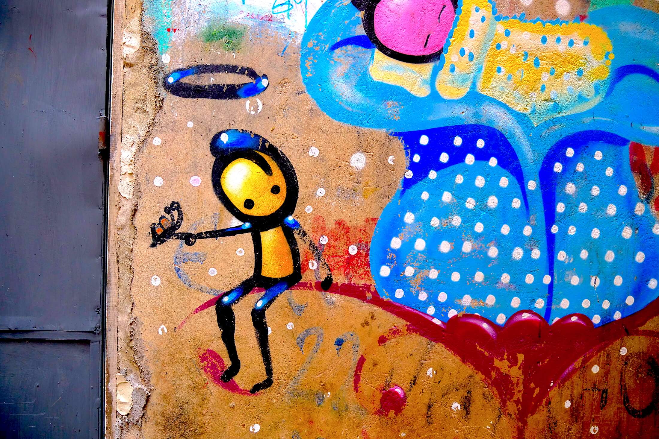
One thing I know you will love about Rio de Janeiro, is how there seems to be art just plastering itself across each and every surface available.
There are few single places in Brazil where you’ll experience this artistic overload like you can in a favela. Due to its large size and huge population density, Rocinha provides moments like this in a sort of rapid-fire way.
As much as anything else in my mind – its this love of art that really describes the country of Brazil to me.
Get exclusive updates
Enter your email and I’ll send you the best travel food content.
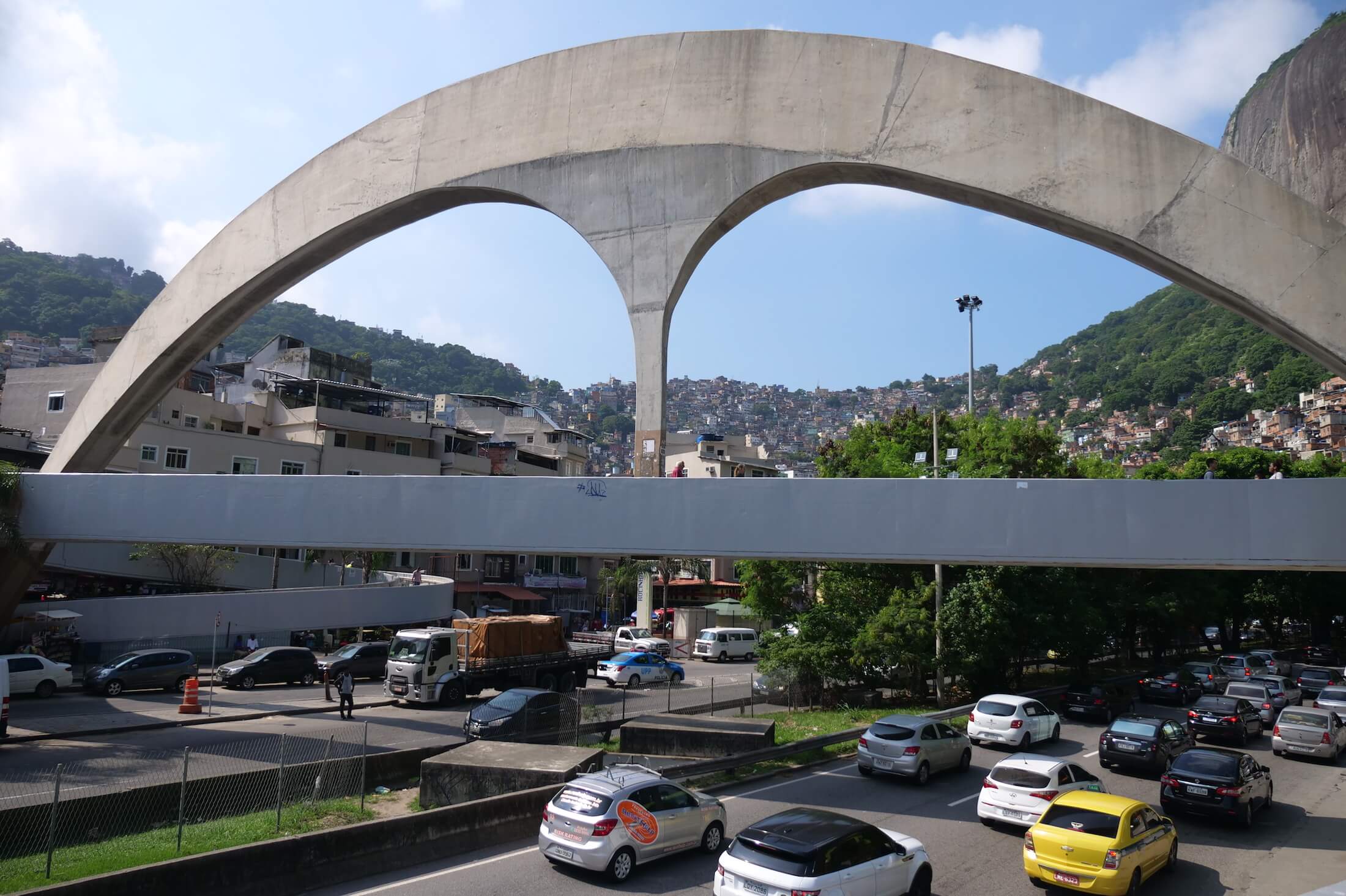
Gate of Heaven – Your First Stop
When you arrive at Rocinha favela, why not make it easy on yourself (more specifically, easy on your knees) and go all the way to the top of the hillside to start.
Take a moto taxi right to the Gate of Heaven view, and believe me when I say this – Hold On Tight! – its about a 15 minute ride. Expect to pay about R$10 (US$2.50) each way.
Moto Taxi Fun
After spending some time getting acquainted with the best kept secret in Rio (the view from the ‘Gate of Heaven’), search around for some wonderful things to eat.
**Note: Visit by bus, or private taxi, Rocinha is in the South area of Rio de Janeiro, near the São Conrado district. You can see many buses with the name in the front window, if you’re traveling by bus then remember to bring change (each ticket costs R$3.60).
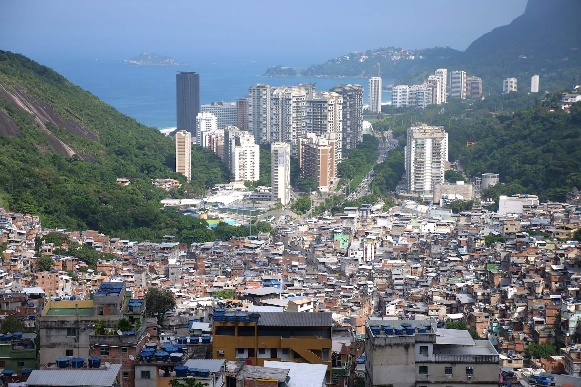
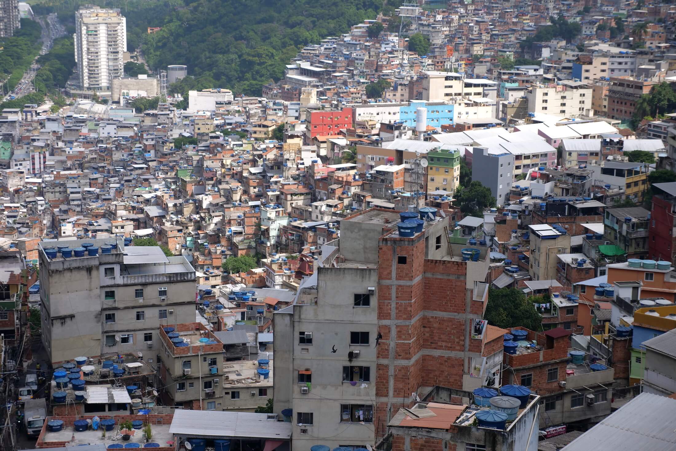
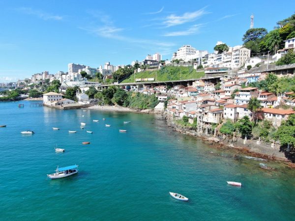
The View
From one of the highest points in the neighborhood, get a spectacular view from this simple lookout spot.
Ask for the “Gate of Heaven,” and gain some wonderful perspective on where you are in the world.
Standing here is so powerful, and you can see thousands of homes, some city structures beyond, and look all the way down to the ocean below.
**Note: In the photo above, notice the silver gray semi-circle of an entrance, right in the center of the photo. This is the door to Rocinha, the place where you may have got off your bus, or possibly began a moto-taxi ride 15-20 minutes ago…
Sensationally Overwhelming
The sensory effect you will experience in a favela can be wonderfully overwhelming – the bustle of every day life, music constantly in the air, the rush of transportation passing when carrying people to work… but I just have to mention the incredible food.
Walking back to the main road after visiting the “Gate of Heaven” viewpoint, prepare yourself to be hit by wonderful waves of smells, from endlessly delicious and inviting small alley-ways.
It is exciting just thinking of the possibilities.
In the afternoon, people like you and I are just coming home to spend time with their families, or enjoying their down time with friends after work. These are all lives which need sustenance, and now let’s get to the first delicious thing that you need to eat in Rocinha!
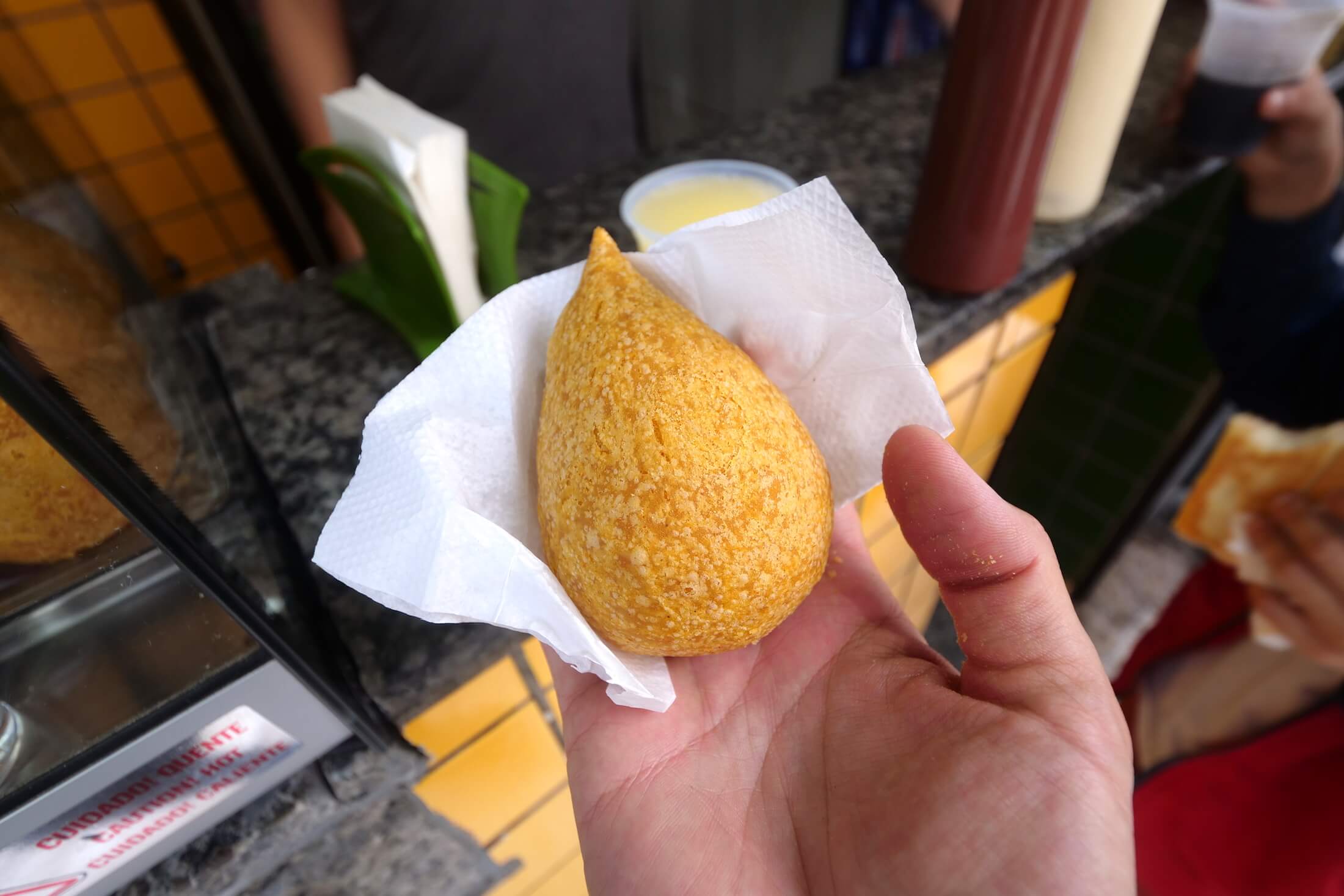
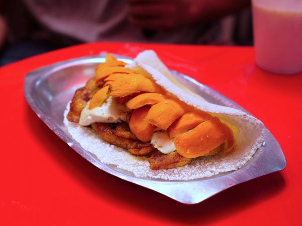
Coxinha
Of all the great snack foods that Brazilian cuisine has to offer, one thing you have to try is ‘Coxinha.’
Snacks made of bread, usually fried in oil, coxinha can be full of chicken, beans and cheese, or any number of hearty and deliciously gooey stuffings.
When you are in Rocinha, enjoy some fresh corn and chicken coxinha (‘coxinha com frango’), something you can find in small shops all along the main street areas.
Good Value for the Price
Ranging from R$2-5 Reais depending on size, this snack can actually be quite filling. I absolutely love the simplicity of this food, and it tastes incredible when you totally cover the gooey insides in chili oil.
A popular snack around Brazil, I can picture this as a local favorite for a cool or rainy morning. Having one of these with a cup of coffee would be wonderful, standing beside a bustling Rio central street.
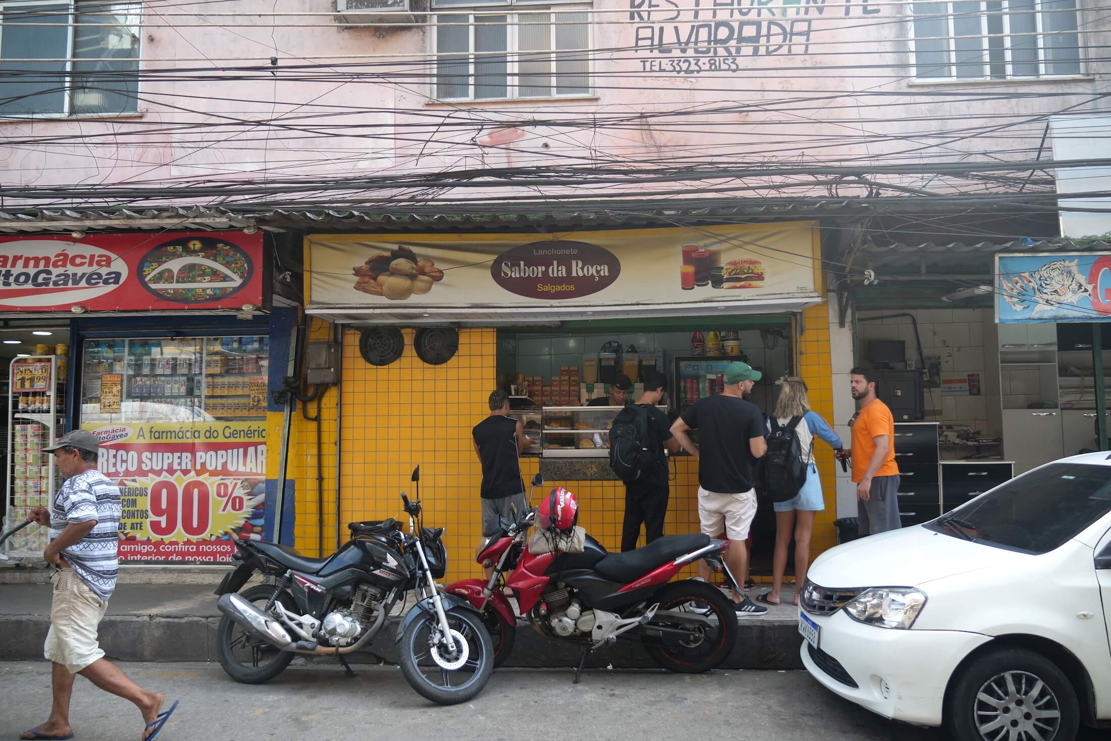
Salgados
‘Salgado‘ means salty, and this is a Portuguese word you need to learn to look for.
From tiny street carts to fancy downtown cafes, people in Brazil just love a few certain deliciously simple and convenient combinations.
It is very common to see a shop sign offering a small cup of coffee alongside a salgado savory snack, sometimes maybe even confusing as either the specific name, or the pairing item, is left out (both are included in a single price, so maybe only one part of it is actually written on the menu).
Look for a ‘completo‘ combination of a simple sandwich or baked item that comes with a ‘suco,’ a fruit squeeze or blend of your choice (and by the way, ‘com‘ means ‘with,’ and ‘sem‘ means without).
Full Meals in a Favela
After some snacks, its time for a full meal.
You can imagine that in a neighborhood full of working class people, there are going to be some deliciously filling versions of Brazil’s favorite local foods.
Combining several different starches and staples into a single plate of food, you can find restaurants serving both cheap and delicious meals all throughout Rocinha.
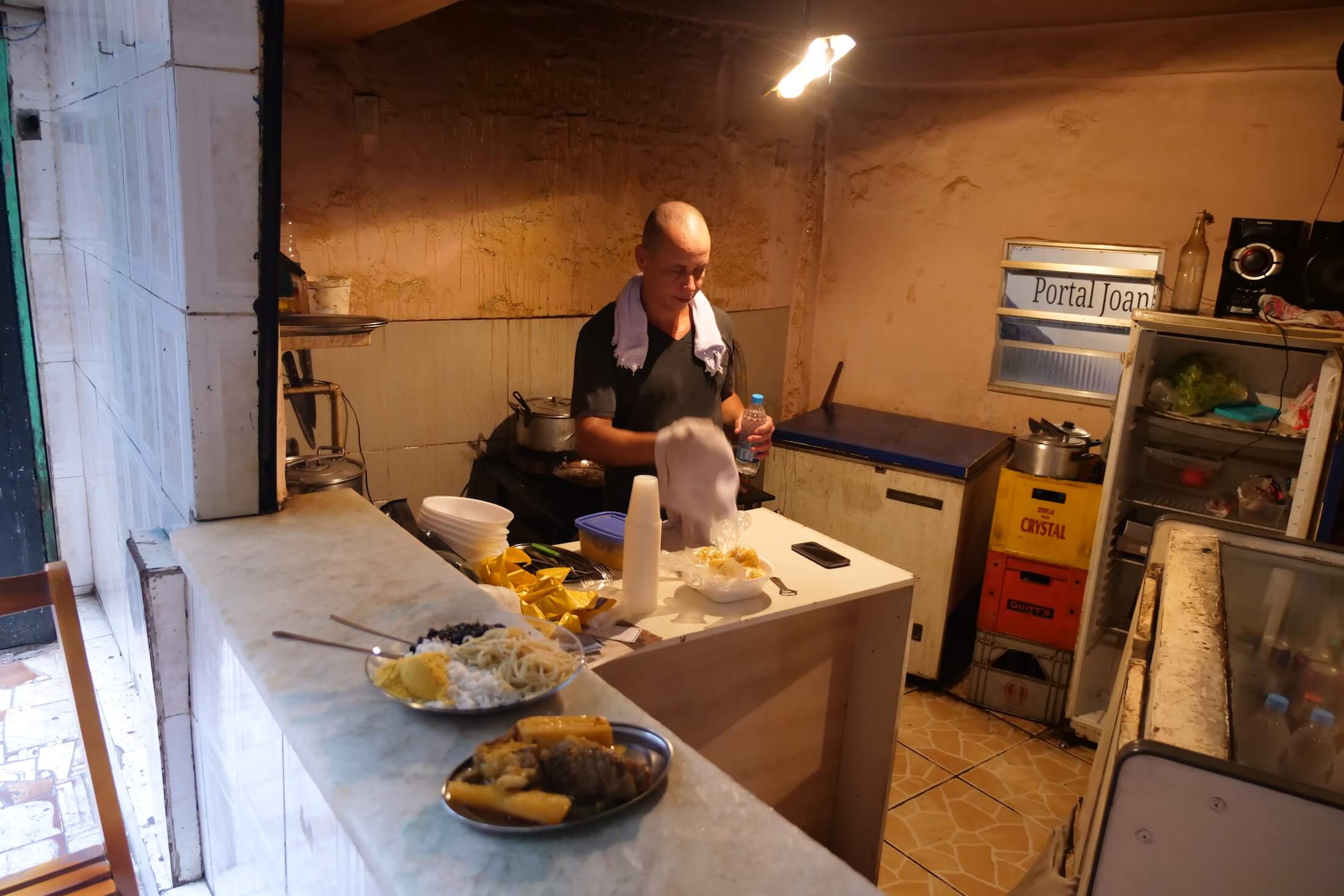
Alexander’s Restaurant
One of the shop fronts we just couldn’t resist is a restaurant owned and run by a chef named Alexander.
His restaurant doesn’t actually have a sign, he is just serving food directly out of his own kitchen – but you know immediately when you walk past that this is a place where you’ll be happy to eat.
You can hear the sound of his cooking and frying, and definitely feel the hunger the moment the top comes off one of his huge pots of stewing beans and pork.
Grab a table, or even better an alleyway counter-top, the best place to experience both the kitchen view, and the street life outside.
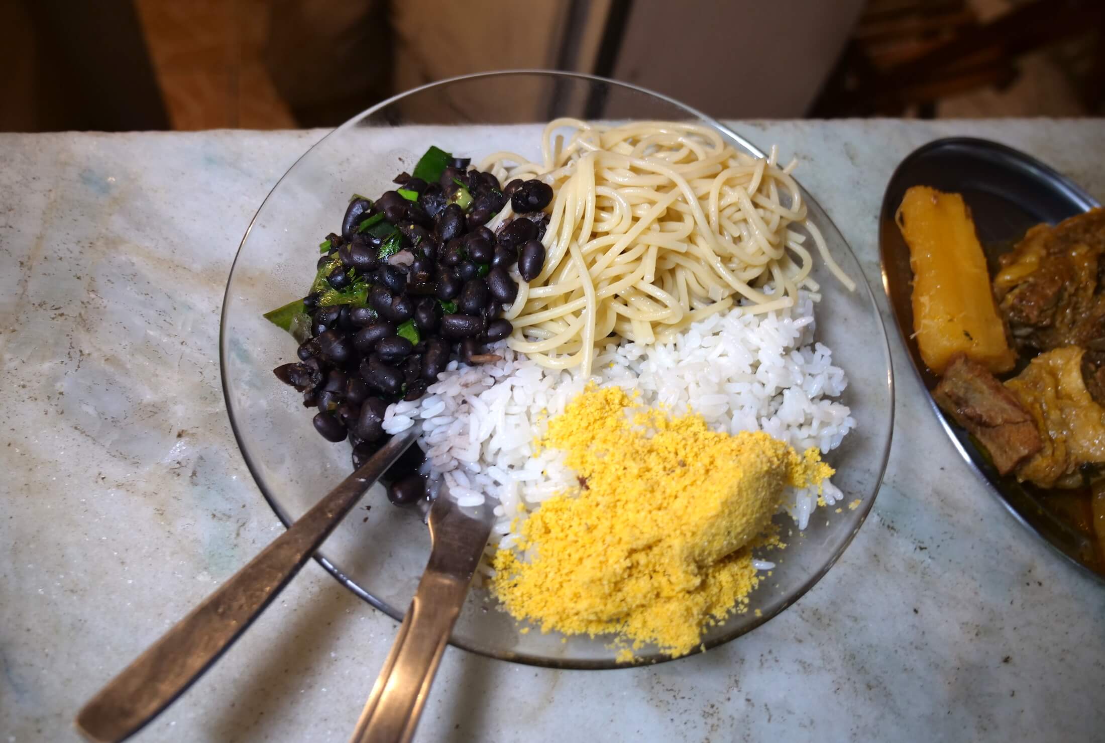
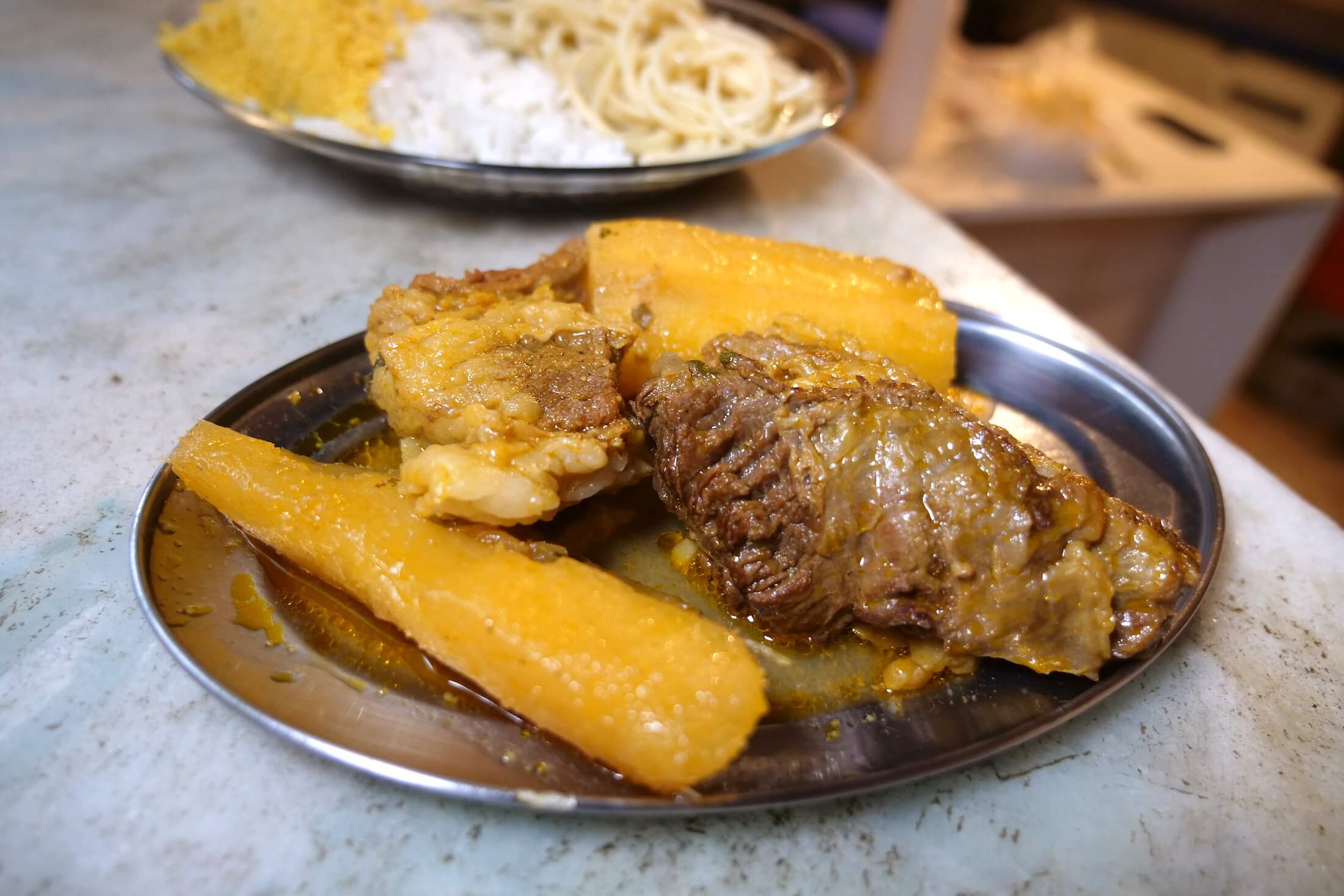
The Main Course
Serving a set combo of really just whatever he cooks up on the day, at Chef Alexander’s you can have an assortment of carbs and meat (pork, beef, beans, and cassava powder), for a set price of just R$10 (US$2.50).
For our meal today, he first serves some spaghetti with white rice, and black beans that he is cooking with a few simple herbs.
On a separate plate he piles cassava and beef that cook for hours, both of which are so soft and wonderfully tender. The beef is just so fatty, and the cassava works well to sort of even out the richness of the meat.
Cover everything with just a light dusting of cassava powder, or ‘farofa.‘ Its crunchy, light, but also soaks up the juices of whatever meats you have around on your plate.
I could be happy eating food like this every day of my life.
Home Cooking and Satisfaction
You can get a great taste of Brazilian home cooking at a place like this, and if you’re in the area, be sure to enjoy at least one meal of a simple, modern-yet-traditional plate of rice and beans.
In favelas like Rocinha of course, there is no end to the amount of small, family-style food options you’ll find.
It is so cool to see how this chef is basically cooking in his own kitchen, serving guests constantly. At night, he will close the door, and go about living in his own house, the same rooms which just hours ago he was opening to people like us to stop by.
Thanks for sharing some of your delicious cooking with us Alexander.
We were lucky to have a translator (thank you very much Rafa and Guilherme for coming with us to Rocinha, and so many other wonderful places around Brazil), and it is experiences like these which really stick in the mind, staying with you long after returning home to your respective country.
Give Them a Voice
Finally, besides the sensory overload, and wonderfully friendly and food-filled experiences, visiting the beautiful people who call favelas home is a way to give them a voice.
Taking time to visit their homes will not only leave a lasting impression on you and your trip, but also serve as a small part of our greater effort to dispel negative feelings towards fellow human beings the world over.
This is something worthwhile in itself, and I urge you to not only follow along with our trip (using the article above), but also use stories of personal experience like this to inspire yourself.
Go out, not only to another country, but even just outside and explore the area around your own home- there are no end to the amount of unique and wonderful memories out there, just waiting to be made when you give them a chance to happen.
More Information on Favelas
Approximately 6% of the entire Brazilian population live in favelas (about 12.5 million people, considering that Brazil’s entire population is over 210 million people (2019)). Therefore, with such a large portion of the population, you can already imagine that the number of ‘normal,’ and hard-working people living here far outweigh those who are there to do harm.
Famous Also for Artwork
Many favelas are even famous for their art, for the giant and incredibly colorful paint schemes that local artists are creating right on and in people’s homes. Many young Brazilian entrepreneurs are making their way in the world using their artistic talents, bringing new ideas and diversity into their favela communities painting the heart of their own history, and their country’s modern day culture.
Wherever you find them, huge murals like these are wonderful. I love walking down the streets in Rio, seeing new art going up literally each and every day, but also plenty of other types of businesses as well. Brazil is a quickly growing country, and growth in the favelas is definitely a necessary and large part of their future as a nation.
Prior to the 2018 Rio olympics, dozens of the largest favelas were completely swept by gigantic teams of police. After clearing the communities of various dangerous members, policemen remained in the favelas, taking up permanent stations which would help give the communities a chance for more peaceful lives.
Final Thoughts
Global media is constantly giving cause for fear in countless situations around the world.
This day visiting favela communities for me, was a day that I can point to and say to myself “here is proof, proof that things are so really and truly beautiful out there, if we just may allow ourselves to know it.”
The television screen is (usually) just the smallest window into the actual truths of what goes on in our giant and wonderful world.
Our Day in Rocinha
This day in Rocinha shows that not only is there no need to be wary of people who are unlike ourselves, but in the moment that we allow ourselves to open up, in the time that we let down our guard and just enjoy the time we’re in, it just may put you right in the perfect place to experience something new.
Something you could grow from, and maybe a positive change that you will never forget.
Chances like these allow us to grow in ways that we could never imagine growing before, and it is because we are willing to go that growth is given a chance to take place.
Gaining insights, not only about food, but also just valuable life knowledge, and finally, even more, some simple and joyful in-the-moment experiences – a few of a traveler’s absolute best rewards.
In the favelas, in Brazil, these moments were many, and moments, like these, are a reason to Travel.
Brazilian Seafood Lunch, with Chef Dona Suzana (Local Hero in Salvador)
Amazon Tapioca Crepes (Jungle Palm Sandwich) in Manaus, Brazil
Get exclusive updates
Enter your email and I'll send you the best travel food content.